
Category:Maps of the history of Paris
Departments of Metropolitan France: Ain [01] · Aude [11] · Bouches-du-Rhône [13] · Dordogne [24] · Haute-Garonne [31] · Oise [60] · departmental district of the Rhône [69] · Savoie [73] · Paris [75] · Seine-Maritime [76]
Overseas departments and regions: Guadeloupe [971] · Réunion [974]
Overseas departments and regions: Guadeloupe [971] · Réunion [974]
Subcategories
This category has the following 10 subcategories, out of 10 total.
*
C
M
O
P
S
T
Media in category "Maps of the history of Paris"
The following 12 files are in this category, out of 12 total.
-
.jpg/120px-291_of_%27(Appleton%27s_European_Guide_Book_illustrated._Italy%2C_Spain_and_Portugal%2C_Russia%2C_Denmark%2C_Norway%2C_and_Sweden._Cont_(11111289484).jpg)
-
.jpg/120px-292_of_%27Illustriertes_kleineres_Handbuch_der_Geographie_..._Dritte%2C_verbesserte_Auflage_bearbeitet_von_Dr._W._Wolkenhauer%27_(11253784146).jpg)
-
.jpg/120px-314_of_%27(Appleton%27s_European_Guide_Book_illustrated._Italy%2C_Spain_and_Portugal%2C_Russia%2C_Denmark%2C_Norway%2C_and_Sweden._Cont_(11118780916).jpg)
-

-
 Cours de la Seine et de la Bièvre au néolithique.png 574 × 413; 529 KB
-
 Dates d'urbanisation des secteurs du Marais.png 346 × 513; 87 KB
-
 Dates d'urbanisation du Marais sur plan satellite.png 350 × 496; 476 KB
-
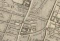 Eglise Saint-Sauveur Paris en 1770.png 920 × 628; 941 KB
-
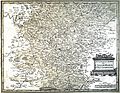 Ilse de France Zeille 13687.jpg 3,558 × 2,756; 9.91 MB
-
 Рис 12 1-й день.jpg 671 × 529; 58 KB
-
 Рис 13 Последний день.jpg 1,475 × 1,146; 125 KB
-
 Рис 14 44 дня.jpg 1,464 × 1,150; 118 KB
.jpg)
.jpg)
.jpg)


